Holy Smokes
Holy Smokes
Just when we think we're going to have a beautiful blue sky week with very few storms in the forecast, we get a surprise.
The skies look white and hazy. It's not because of clouds.
That milky white appearance is all because of Canadian wildfire smoke that has traveled through our atmosphere from northern Alberta and British Columbia. Smoke has been seen from Washington to Montana, through the upper Midwest, and into Missouri and Illinois.
Before you worry too much about the smoke, I want to let you know that this happens frequently. Whether it is wildfires in Canada, California, or even dust from the Saharan Desert, it's not unusual for these particulates to appear in our skies. It's especially common during the warmer months.
Sometimes the smoke travels to the surface and can impact our air quality. In this situation, the smoke hasn't caused problems for most across Missouri and Illinois. The reason is the smoke is several thousand feet above the ground and trapped in the jet stream. The only particulates impacting our air have been low-level ozone, which is why the air quality is in the moderate category.
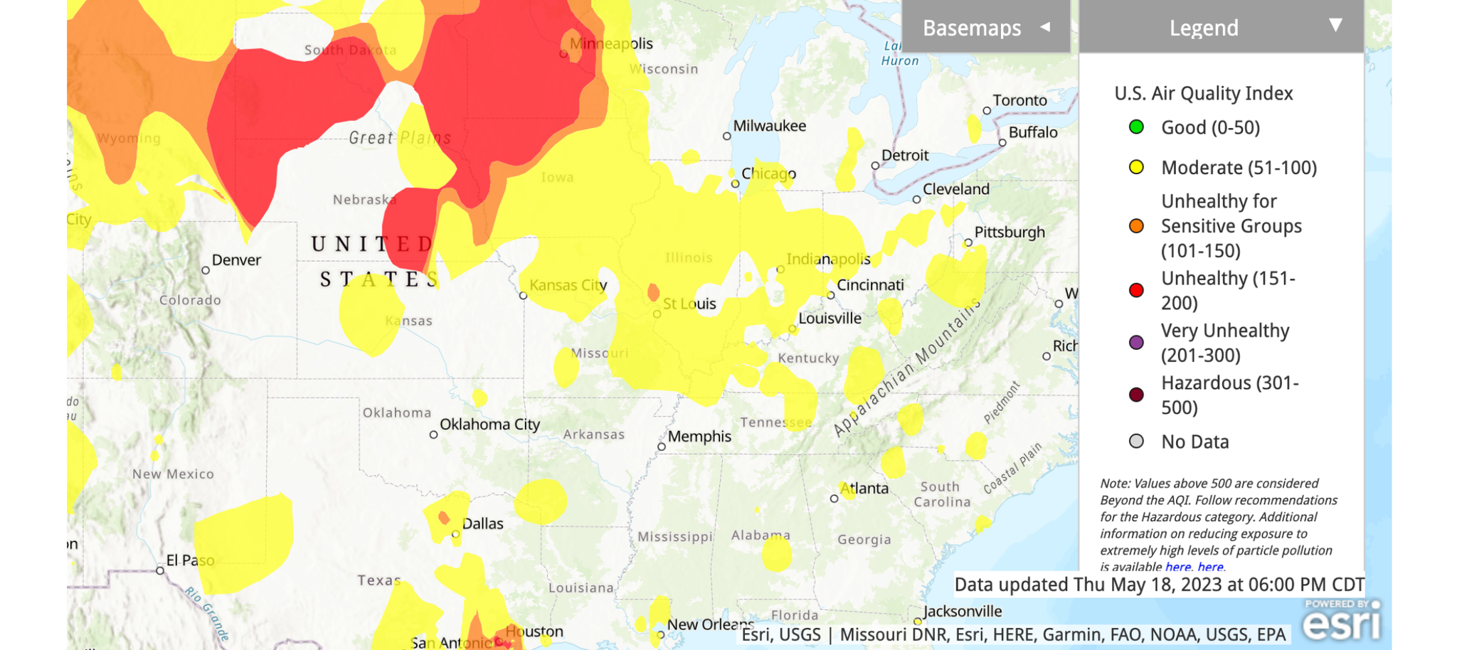
The same can't be said for Washington through parts of Minnesota and Wisconsin, where some of that smoke has been pushed to the ground and has caused problems for sensitive groups or those with breathing problems.
While, so far, we haven't been impacted by poor air quality, we need to be watchful through the weekend. Some smoke may move lower in the air, causing breathing problems for sensitive groups. Otherwise, unless you are sensitive to air quality, this won't pose a problem.
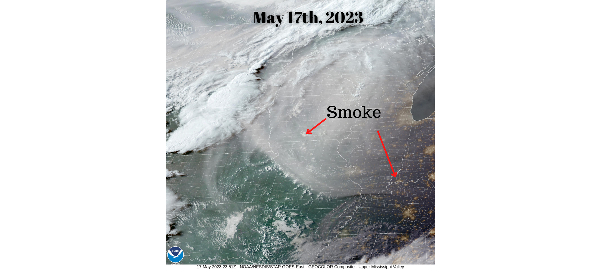
The crazy thing about this smoke is that it is visible both from the ground, where we see that milky white color, and from satellite imagery.
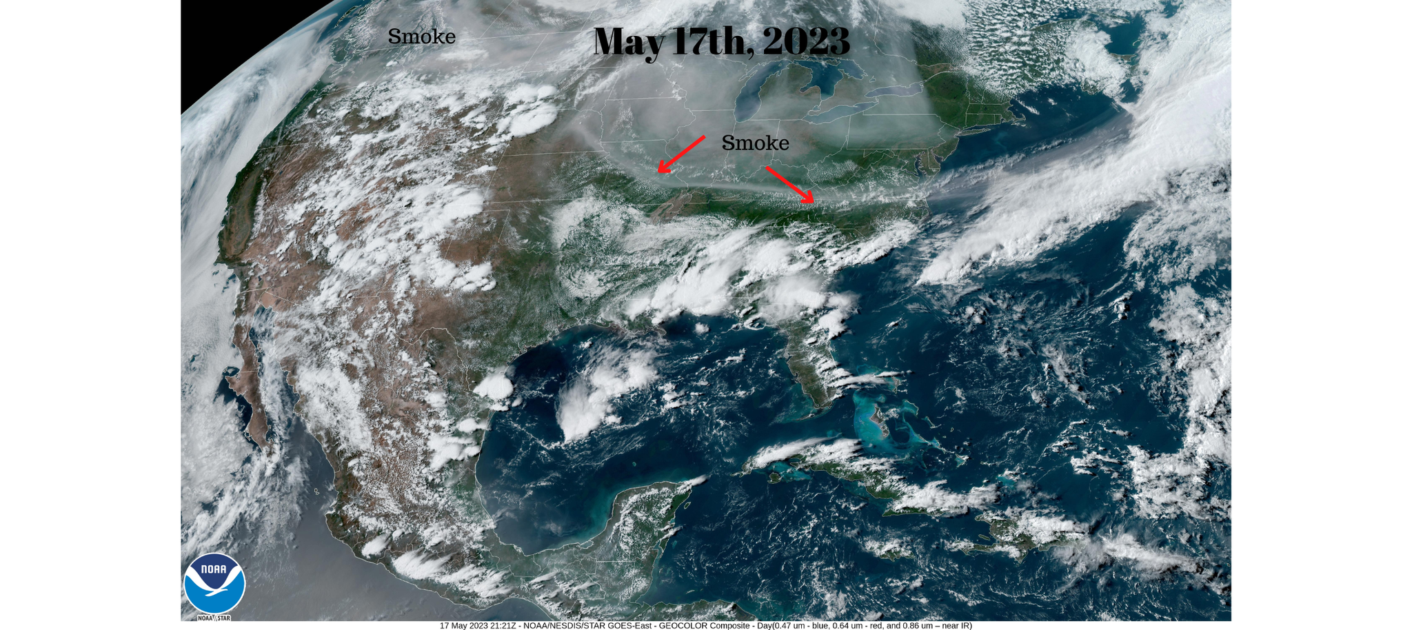
The GOES-West satellite captured images of the smoke. It was especially noticeable on May 17th when it first entered our skies. We also had little cloud cover that day which made it particularly visible.
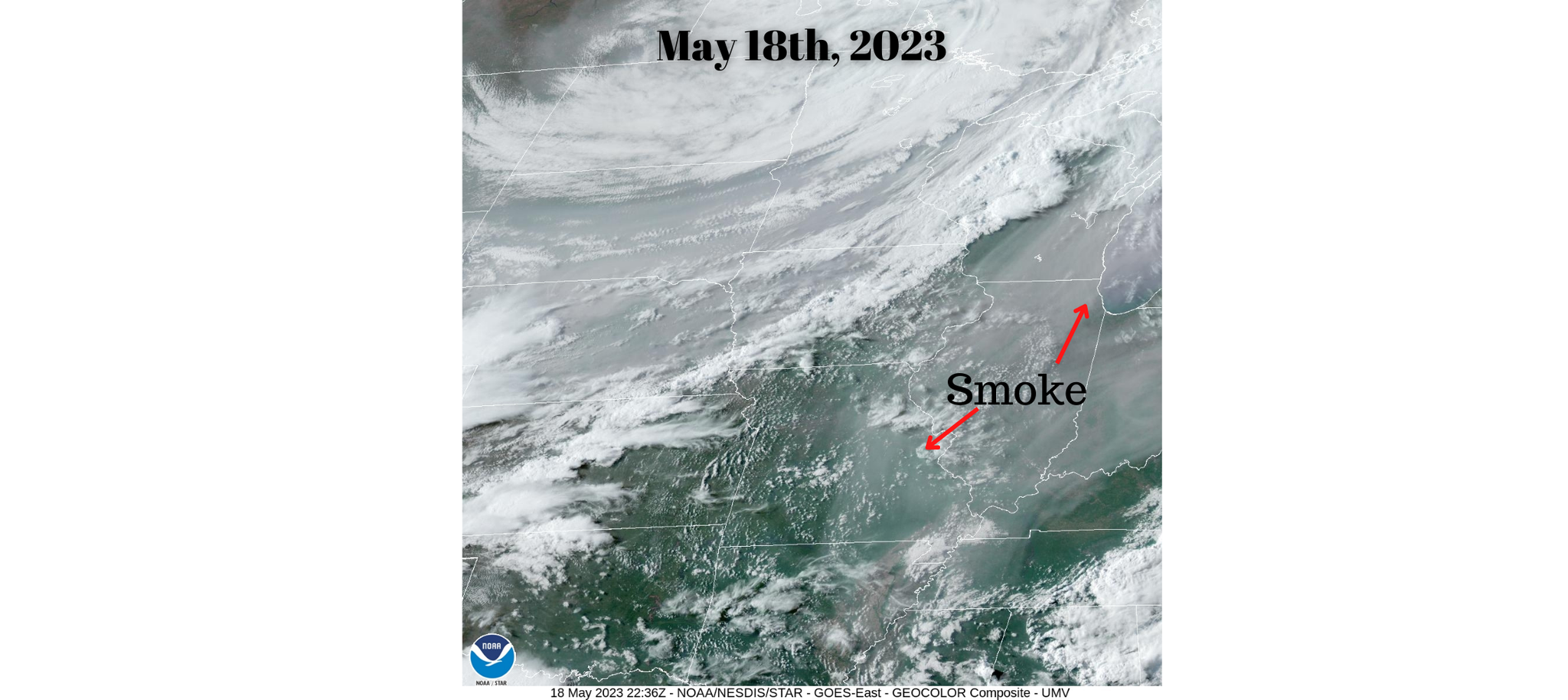
On the 18th, the smoke was thicker in the air. However, in Missouri and Illinois, we had a bit more cloud cover making it slightly harder to see from satellite imagery.

The smoke, as you saw above, is visible on satellite imagery, but analysis of the wind pattern high up in the atmosphere can be used to see the path the smoke has traveled.
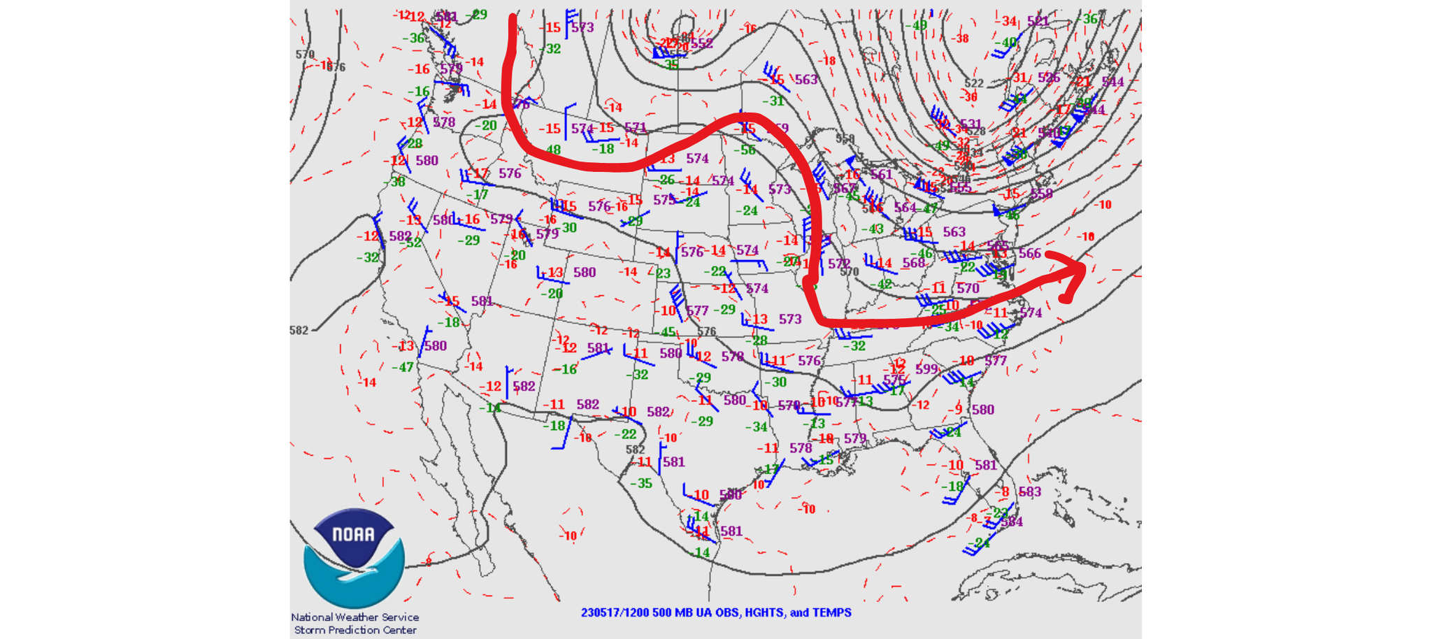
Below is an upper-level air map from the 17th with a line drawn along the wind barbs to show the direction of the smoke. The smoke traveled south from west Canada, looped through Montana, and then dived south into Missouri.
This map is of the current upper-air wind pattern. We also have maps available which display the forecast for the upper-level winds.
Based on that data, we could see hazy and milky white skies through Sunday. If the fires still burn and produce smoke into next week, the upper-level winds may keep the smoke north of our area.
What's great is all the data meteorologists use to see the smoke is free for the public. You can explore NASA Worldview or NESDIS NOAA to view the images.

1 Comment Add a Comment?
Mark Krause
Posted on May 24, 2023, 5:23 a.m.
Leah, great explanation!