The poles called… they want their cold air back
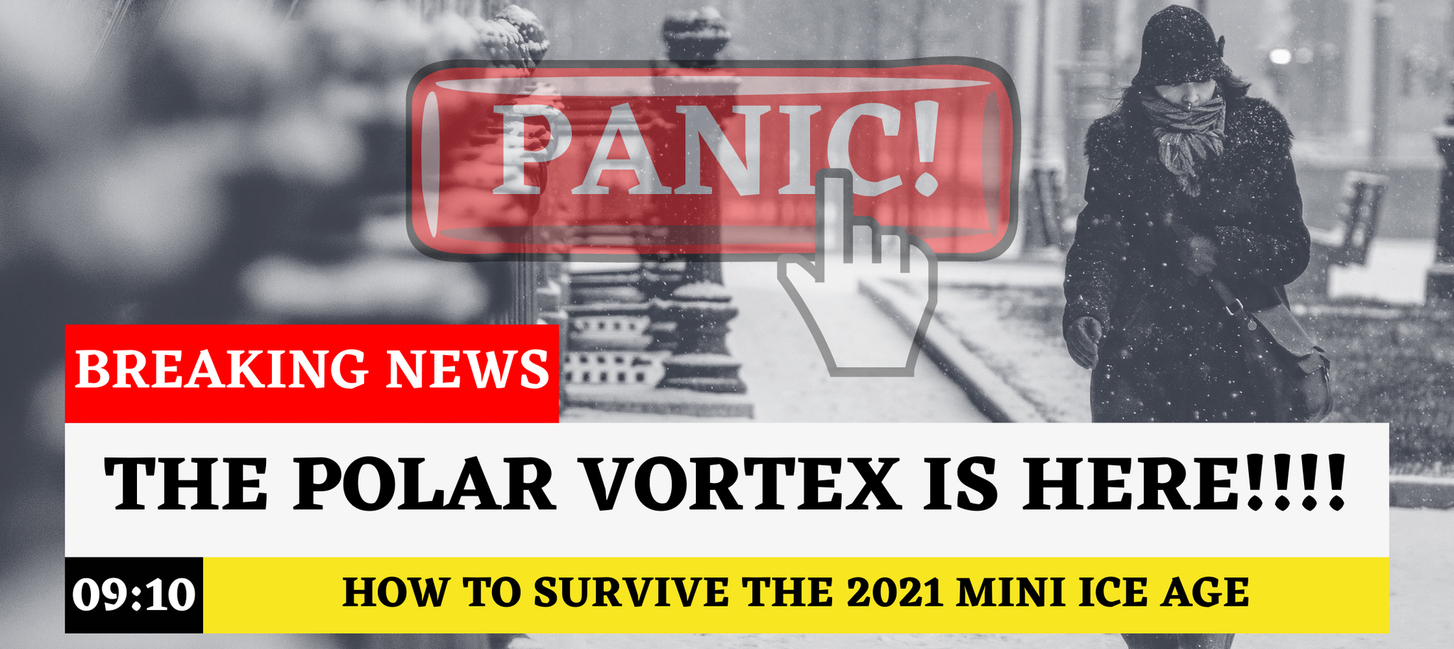
THE POLAR VORTEX IS COMING! “Chunks of the polar vortex to drive freezing air far south!” Or, “the Polar vortex is back and here to stay!” These headlines do make good clickbait. If you do not read past the headline you would think the world is entering a mini ice age. The polar vortex is not new, nor are the impacts. The polar vortex also is not COMING because it is always HERE. I have another bomb to drop, there is not just one polar vortex, but two. We have the stratospheric polar vortex and the tropospheric polar vortex.
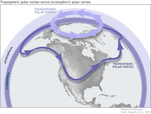
Think of the atmosphere like a family. The stratosphere is a calm and collected older brother, and the tropospheric polar vortex is the wild little brother.
Breaking it down - Little brother tropospheric polar vortex
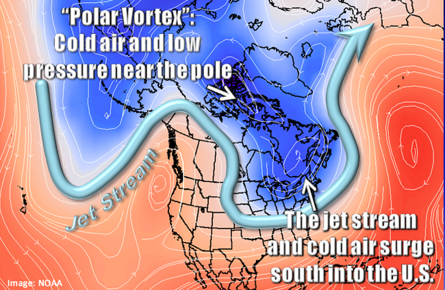
It may come as a surprise, but the tropospheric polar vortex is what you are most familiar with because it occurs all year long. It acts as the separation between the colder air found north in the poles, and the warmer tropical air to the south. The U.S. is located in a region known as the mid-latitudes, where these air masses come together. The strong gradient of cold and warm air creates an area of fast-moving winds known as the jet stream.
As the tropospheric polar vortex expands and contracts, it causes the jet stream to dive south or retreat northward. In winter, the southward dip of the jet stream often brings colder air into the U.S.
Big brother stratospheric polar vortex
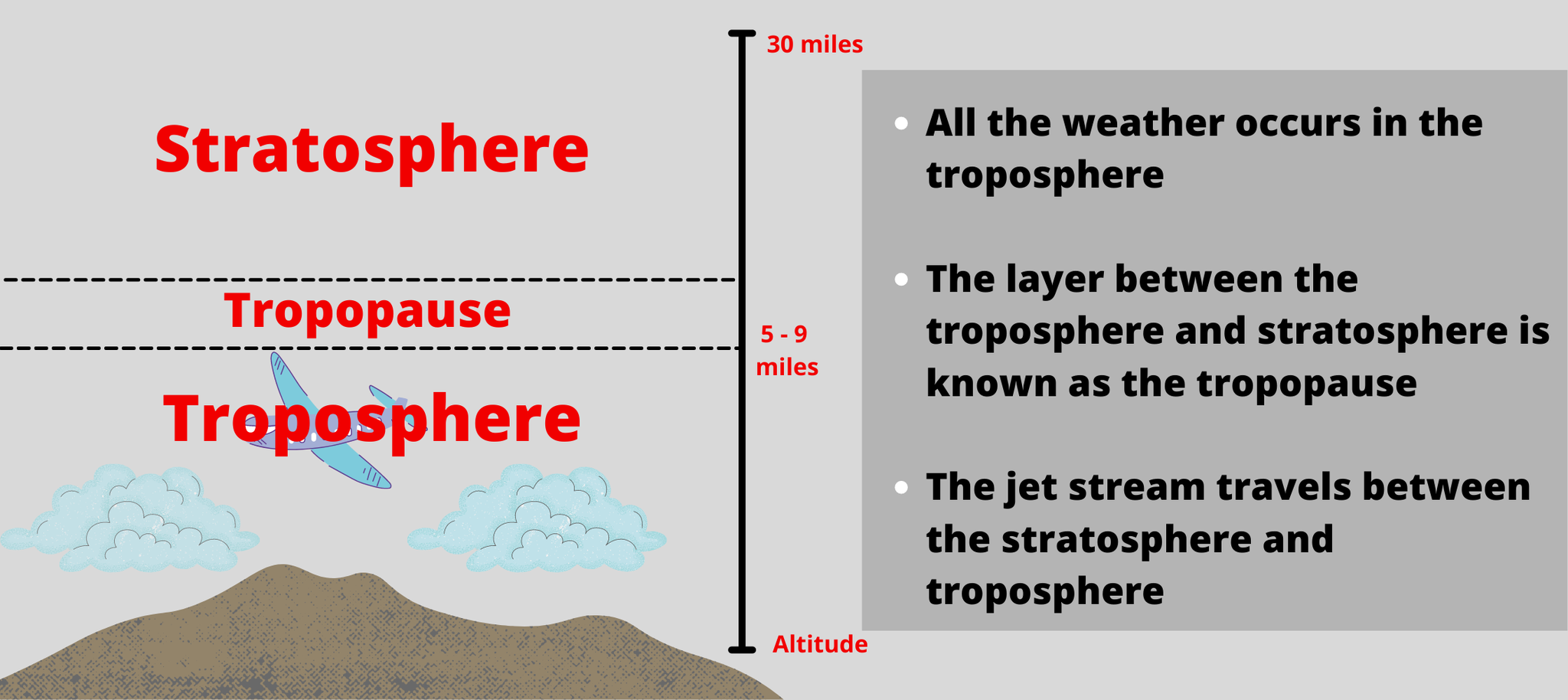
The stratospheric polar vortex only appears in the winter. It resides in the polar region and extends about 5 to 30 miles above the surface. Compared to the tropospheric polar vortex, the stratospheric polar vortex is more chill. Strong winds flow in a circular pattern around the poles, typically from west to east, unless disturbed.
This disturbance is caused by the troposphere that likes to push big brother’s buttons. In winter, the tropospheric polar vortex disturbs the stratosphere with energy and momentum. The dispersion of the energy and momentum warms the stratosphere and weakens the winds. Eventually, the stratospheric polar vortex has enough of its little brother's antics. The vortex breaks down and reverses wind direction. This wind reversal is known as a major Sudden Stratospheric Warming. The stratospheric polar vortex now disrupts its younger brother with a downward propagation of momentum. This leads the jet stream to take on a more wavy pattern sending cold air southward with each dip. An SSW forced by the vortices can lead to cold air outbreaks in the U.S.
Remember, an SSW does not guarantee a cold air outbreak in the U.S. The stratosphere can continue to warm and cause the jet stream to retreat northward. In this case, we may see above-average temperatures and a mild winter.
So… What happened in January? And why is it so cold now?
The weeks before January, the stratospheric polar vortex was undergoing many disruptions from the troposphere. Eventually, the disruption led to a reversal of the winds on January 5th. On that day, an SSW occurred. Since then, meteorologists have been watching long-range models closely, knowing a more wavy jet stream pattern could bring colder air to the surface.
There is about a month's delay between when the SSW occurs and when cold air impacts the U.S. The SSW on January 5th was a dominant mechanism behind our current cold weather pattern. So, when your friends complain about it being cold outside, you can reference this article and explain how this upper atmospheric process is partly to blame.

0 Comments Add a Comment?