And we're off! Hurricane season starts today
Today, hurricane season officially begins. Already we have had Tropical Storm Ana, which formed outside of the regular season but quickly dissipated after a few days. 2021 is the seventh consecutive year storms formed before June 1st. It's also the fifth year in a row the National Oceanic and Atmospheric Administration (NOAA) has predicted an above-average hurricane season.
You can read more about the predictions for this upcoming season by clicking HERE.
To honor the start of hurricane season, I want to take you back a few years and their above-average activity.
2016- First above-normal hurricane season since 2012
2016 brought an above-normal hurricane season for the Atlantic, eastern Pacific, and central Pacific. For the Atlantic specifically, this was the first above-normal season since 2012.
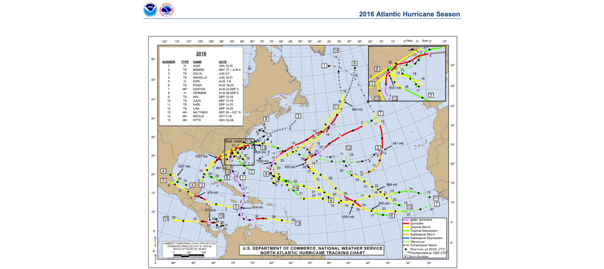
The Atlantic saw 15 named storms, seven hurricanes, and four major hurricanes. A majority of the cyclones affected land, with five landfalling storms in the United States, the most since 2008.
The season jumpstarted unusually early in January when Hurricane Alex formed near the Bahamas. Three storms formed between late May and late June, which is earlier than the climatological average. Five storms formed in August, five in September, one in September, and a late storm in November.
Hurricane Matthew was the strongest, costliest, and deadliest storm of the season. Matthew was the first Cat. 5 storm to form in the Atlantic since Hurricane Felix in 2007. The storm reached major hurricane strength on Sept. 30th in the Caribbean Sea and maintained major hurricane strength for eight days. The storm made landfall in Haiti, Cuba, and the Bahamas as a Cat. 4 hurricanes. Matthew eroded part of the Florida coastline and produced 10 inches of rain causing flooding in the eastern Carolinas.
2017 - Extremely active season
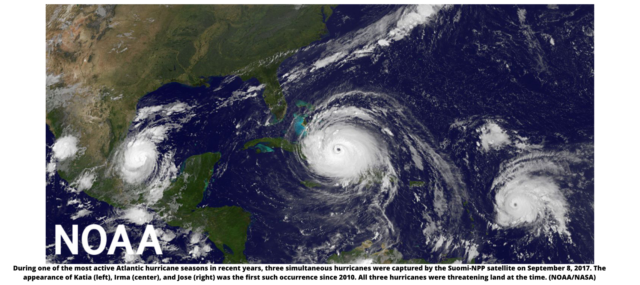
The NOAA predictions for an above-average season were verified in 2017 when the season ended with 17 named storms, 10 of which became hurricanes with six major hurricanes. Two major hurricanes hit the continental U.S. for the first time in 12 years. It was the seventh most active hurricane season on record. The first named storm of the season was Tropical Storm Arlene which formed on April 20th, kickstarting the season early. Hurricane Harvey devastated Texas, while Irma caused extensive damage to the Caribbean and the southeastern U.S. Another major hurricane was Marie which struck the Caribbean and Puerto Rico. The four other storms to impact the U.S. were Cindy, which also hit Texas, Emily, Phillipe, and Nate.
Forecasters during the season were also able to utilize pre-operational imagery from the new satellite, GOES-16 (Read all about satellites by clicking HERE). Forecasters were able to create tracks with even greater detail than before because of the new imagery. Storm Surge Watches and Warnings were launched during the 2017 season, providing life-saving information and forewarning.
2018- A destructive season
15 named storms formed during the 2018 season, Eight of those storms reached hurricane status, with two major hurricanes. 2018 also marked the fourth year in a row of tropical activity beginning before the June 1st start date. Alberto formed on May 25th, making landfall in Florida before traveling north into the Great Lakes as a tropical depression.
Hurricane Florence caused catastrophic flooding to North and South Carolina. Damages totaled $24 billion, and 30 people died as a result of the hurricane.
Michael was a major Cat. 4 hurricane and was the strongest hurricane on record to strike the Florida panhandle. Michael was also the third most intense hurricane to make landfall in the U.S. Damages totaled $25.5 billion with 31 fatalities.
2019 - Many major hurricanes
Another above-average hurricane season wrapped up with 18 named storms, including six hurricanes, of which three were major hurricanes. Five tropical cyclones formed in the Gulf of Mexico, and four storms made landfall in the U.S. during the season.
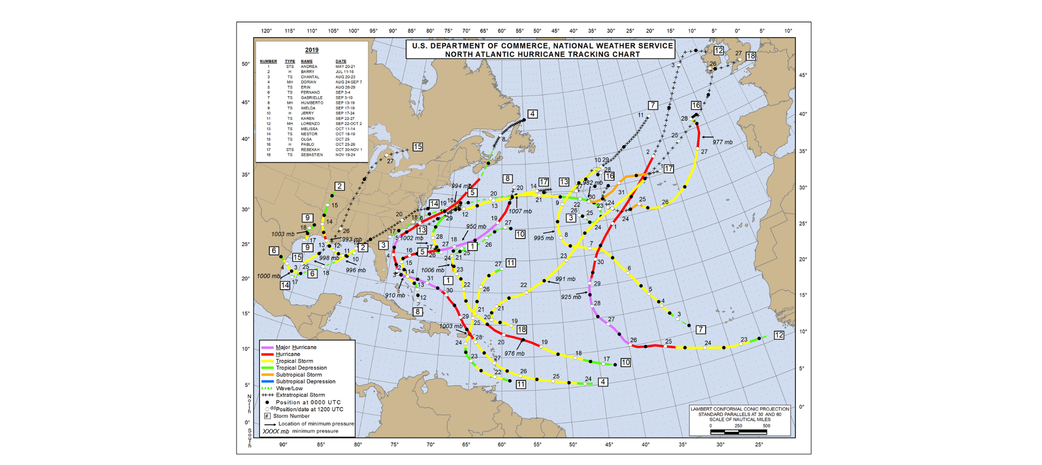
Hurricane Dorian holds the reputation as the slowest but most destructive storm to hit the Bahamas during recorded history. One meteorologist reported the storm only tracked 25 miles in 24 hours. Dorian reached a max strength of Cat. 5 with estimated winds reaching 185mph during its peak intensity. Wind gusts, however, reached upwards of 220mph. In total, Dorian was responsible for over 200 deaths.
Hurricane Barry was another slow-moving cyclone impacting Louisiana and resulting in $600 million in damages. The storm was a tropical depression as it moved into Arkansas. Hurricane Lorenzo was another Cat. 5 hurricane with winds upwards of 160mph.
2020 - All the records broken
Last year was the most active hurricane season on record. With 30 named storms developing into 13 hurricanes and six major hurricanes. 2020 broke the previous record of 28 named storms set in 2005.
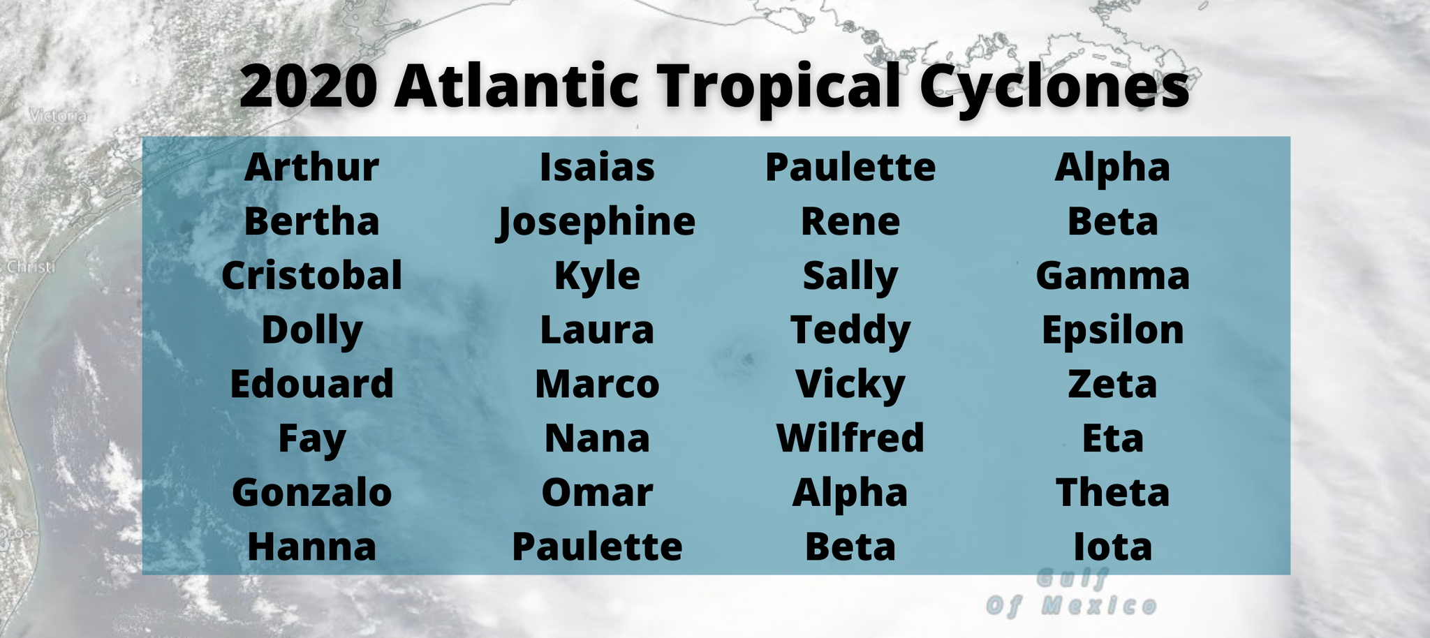
The 2020 season started rapidly with a record of nine named storms formed between May through July. It was only the second time in history we exhausted the original 21 name hurricane list and moved to the backup list of Greek names. The first time this happened was during the 2005 hurricane season.
The season saw 12 separate storms making landfall in the U.S, which broke the previous record of nine set in 1916. Five of those landfalls occurred in Louisiana, which set another record for most landfalls in a single state during a season.
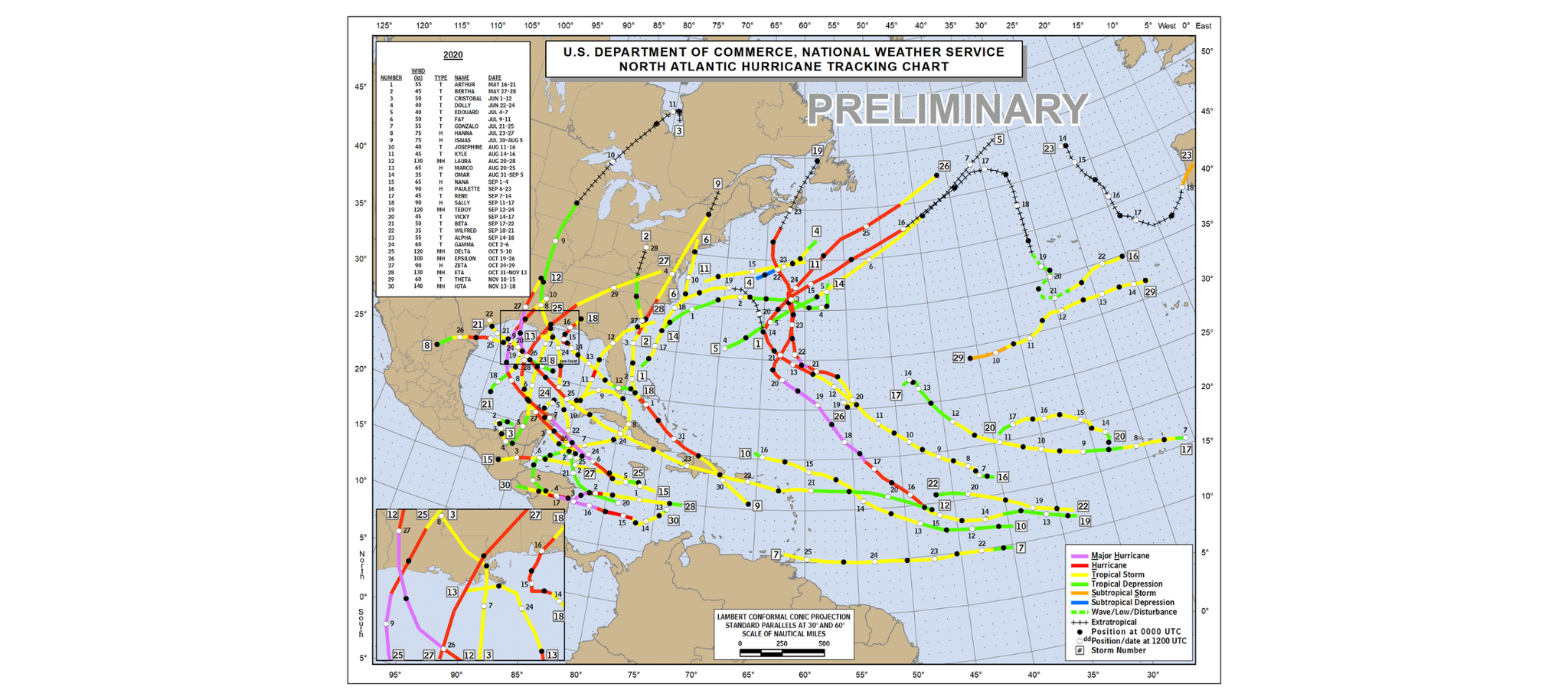
September saw ten tropical storms forming, which is the most for any single month on record. November had two major storms forming, Eta and Iota, making it the first time we had two major hurricanes in November. Iota reached Cat. 5 intensity, making it the strongest storm to occur late in the season.
Another notable fact, the season marked the second time in history where three tropical storms formed on the same day. On Sept. 18th, three storms reached tropical cyclone strength within six hours. On Sept. 14th, there were five tropical storms at once, they were Paulette, Rene, Sally, Teddy, and Tropical Depression Twenty-One. However, this does not break the record for most storms at once, 1971 holds that record when six tropical cyclones were active.
2020 also marked the fifth consecutive year in a row with at least one Cat. 5 hurricane. The season was longer, with storms before the regular season start date of June 1st.
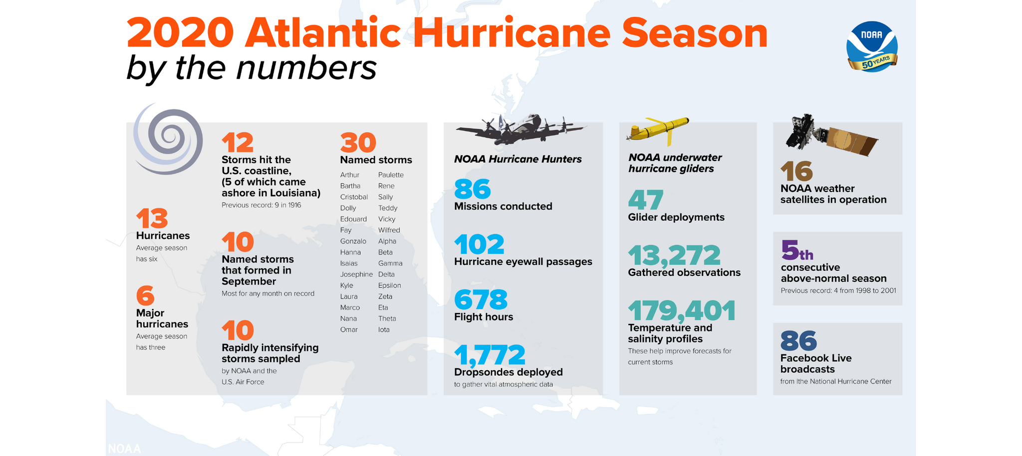
Two troubling features appeared during the 2020 season, rapid intensification of storms, and slower-moving storms. Rapid intensification increases a storm’s sustained wind speed of at least 35mph in 24 hours. Ten of the 13 hurricanes forming during the season underwent rapid intensification.
Storms also moved slower. With two hurricanes, Sally and Eta, stalling. This follows a trend over the last few years of slower-moving storms; Hurricane Dorian in 2019, Hurricane Florence in 2018, and Hurricane Harvey in 2017 are other examples. Slower hurricanes produce more damages from winds and flooding.
What about 2021?
NOAA released their outlooks a couple of weeks ago, which I discussed in my post last week, and you can read it by clicking HERE. Only time will tell how the outlook verifies. Hurricane season ramps up later in the summer, and we can only hope for no landfalling storms and weaker hurricanes.

0 Comments Add a Comment?