Get ready to be blown away
A wind comes in the form of a light summer breeze or barreling into a region. Here in the Ozarks, we get strong gusts, high winds in thunderstorm outflow boundaries, or even feel the swirling impacts of winds within a tornado. Winds coming from the south give us a clue about warmer air, while a northerly wind tells us a cooler air mass is moving in. Dramatic wind shift? Likely a front just passed through.
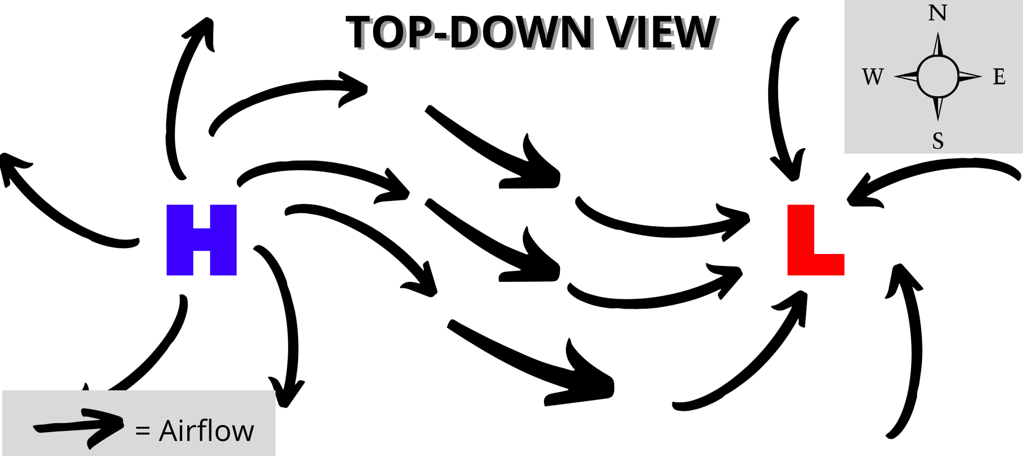
So what causes wind? In the atmosphere, air flows from high pressure towards low pressure, the movement of air creates the wind. The greater the difference is between the high and low pressure, the stronger the wind.
Wind gives us clues on the type of weather we can expect. In this post, I’ll talk about a few of the factors meteorologists account for when forecasting wind, and how they play a role in our temperature forecasts. I’ll focus on the non-severe winds in this post. I’m also greatly simplifying things and assuming winds are the only weather drivers.
Importance of wind direction
When forecasting, meteorologists are not just looking at their local forecast area but the air all around. Knowing the wind direction gives clues on the air mass moving in and potential impacts on our weather conditions.
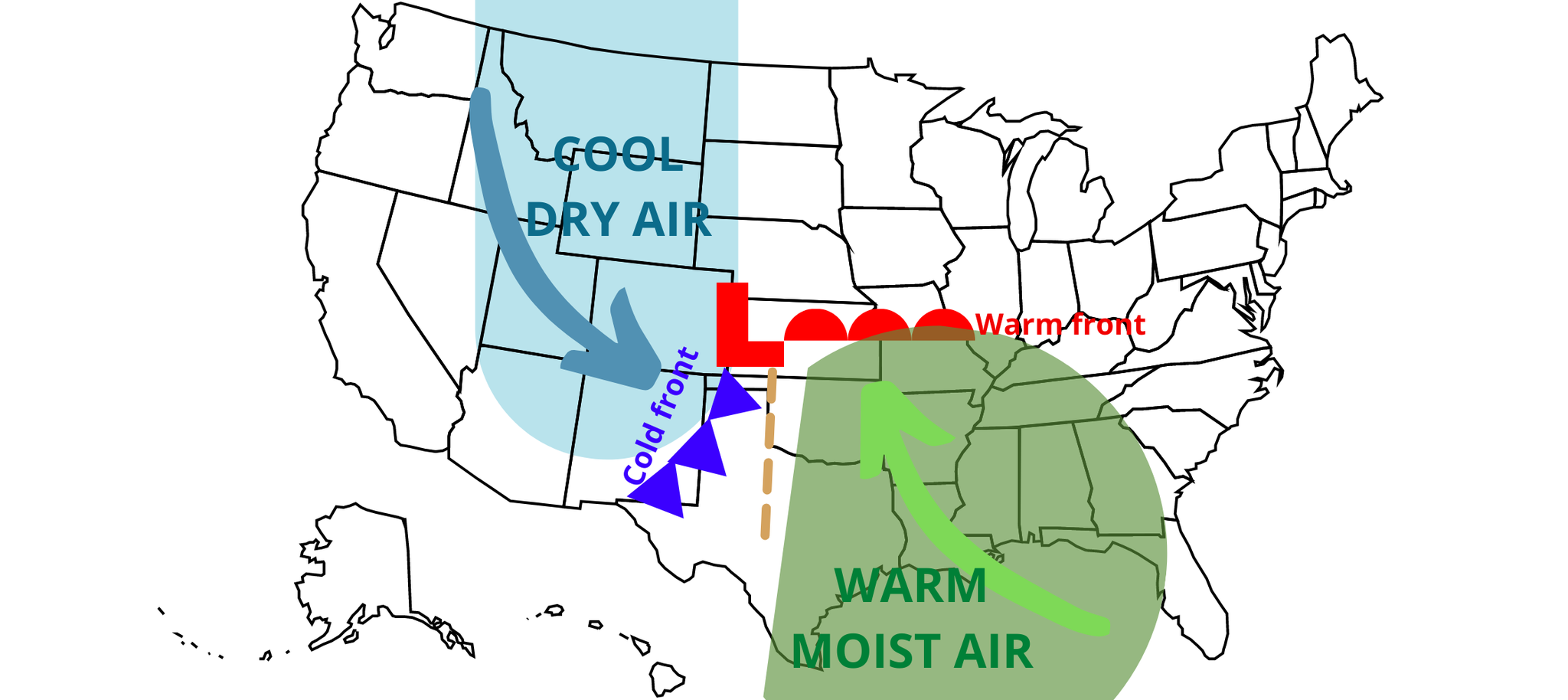
For example, just to our south, we have the Gulf of Mexico providing warm air and rich moisture. To the west, we have warmer and drier air. From the north, the air is cool and dry. If we have a strong southerly wind, it will often bring a warmer and more humid air mass.
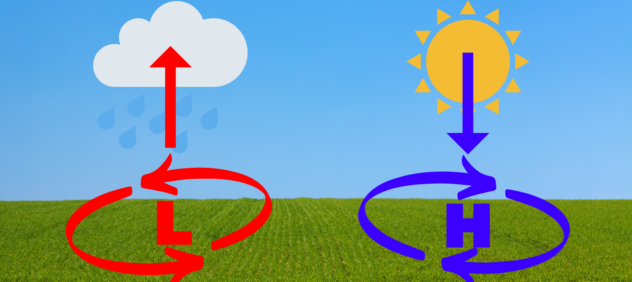
In previous posts, I’ve touched on how winds flow around high and low pressure. If low pressure is moving in, winds are flowing cyclonically, or counterclockwise, around the center of low pressure. Storms are often associated with low pressure. Around high pressure, the winds flow counterclockwise, or anti-cyclonic. High pressure often brings us warm and drier weather.
High or low pressure often have fronts associated with them. You may notice a front passing through because of the wind shift or a change in temperatures. Cold fronts tend to have more dramatic wind shifts with cooler air behind the front.
Winds as a forecasting tool
How does wind affect temperatures? Well, winds cause vertical mixing of temperatures higher in the atmosphere with the surface. A stronger wind will reduce the difference between the highest and the lowest temperature of the day. Light winds increase the difference between the high and the low temperatures. The following examples assume no other factors are influencing our weather, such as, cloud cover, or storms.
Let’s focus on daytime winds first. Say we have a strong wind during the day. As the sun warms the surface, the warmest temperature in the atmosphere will occur at the surface, with temperatures decreasing as you go up in the atmosphere. Strong winds allow for cooler air aloft to mix with the warmer air below. This mixing causes cooler surface temperatures.
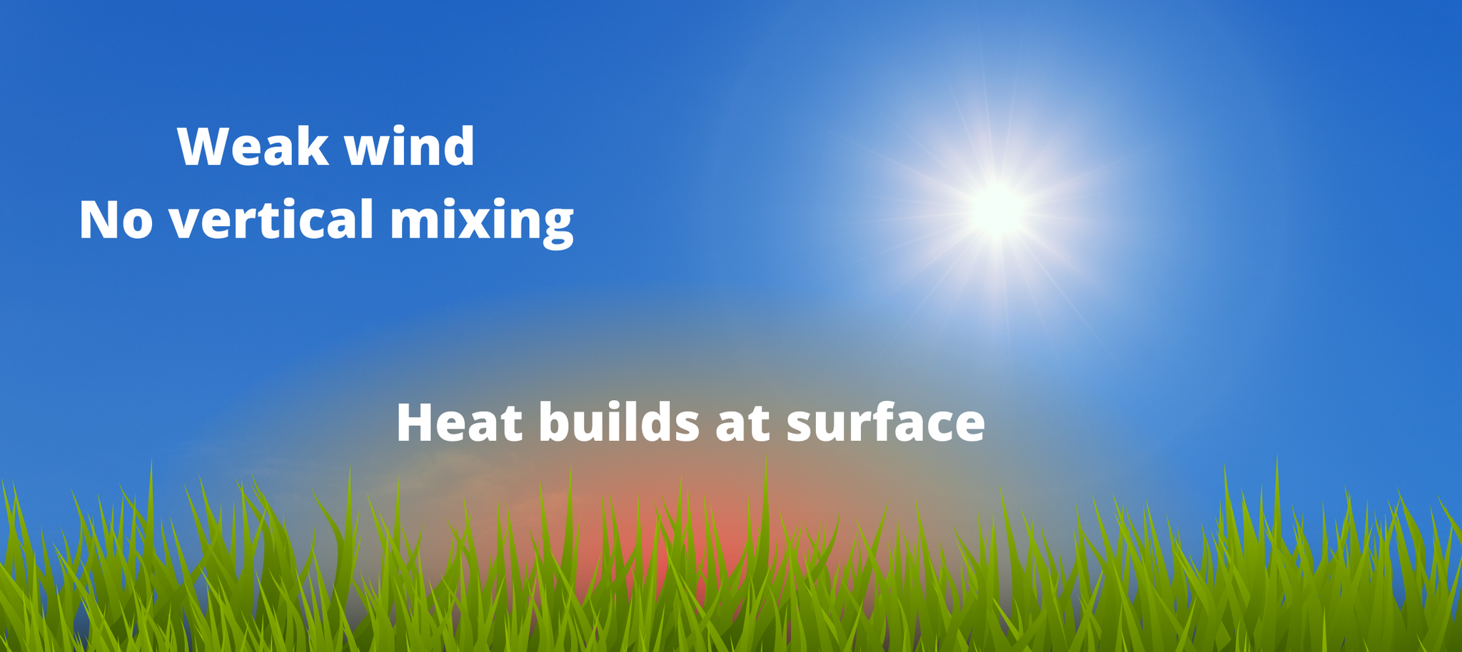
If the winds had been light, then there is little vertical mixing of the cooler temperatures aloft and warm surface temperatures. In this case, the heat will build up.
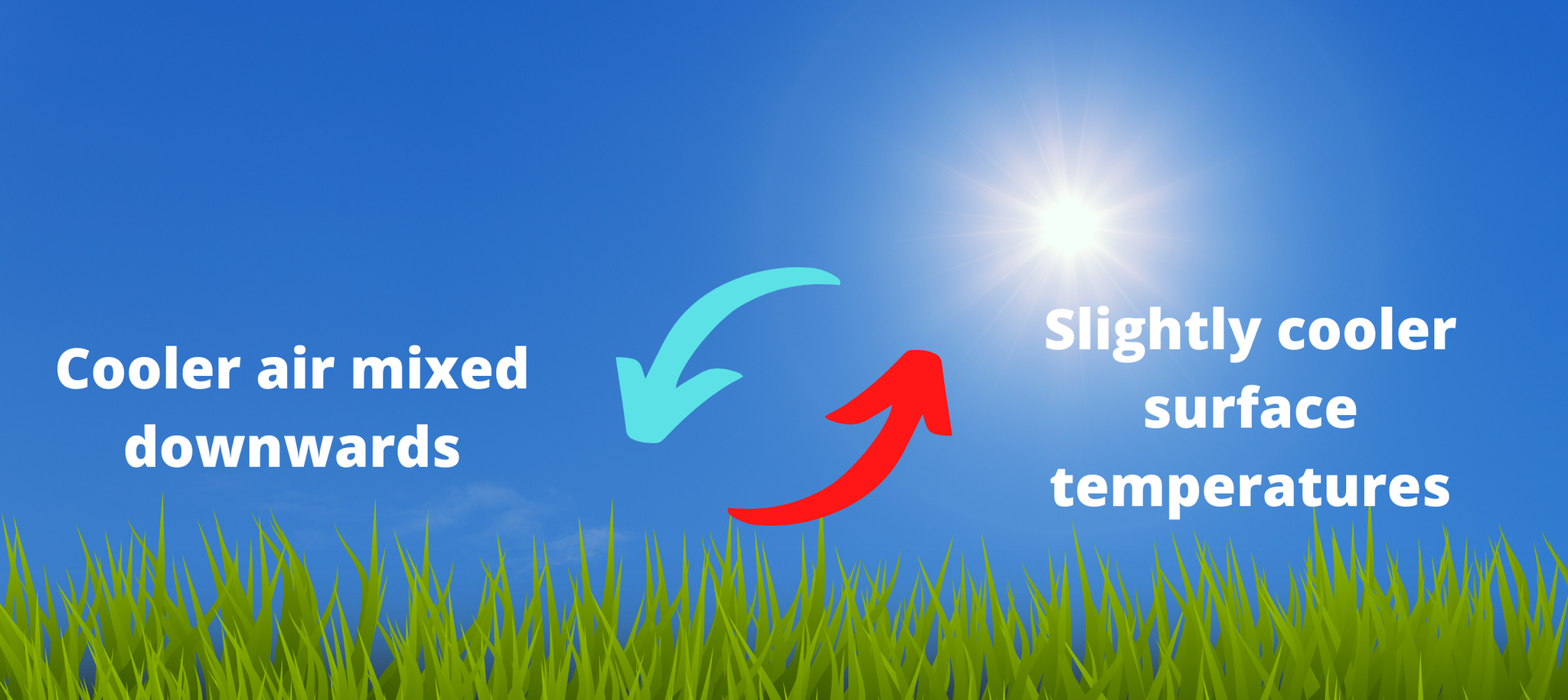
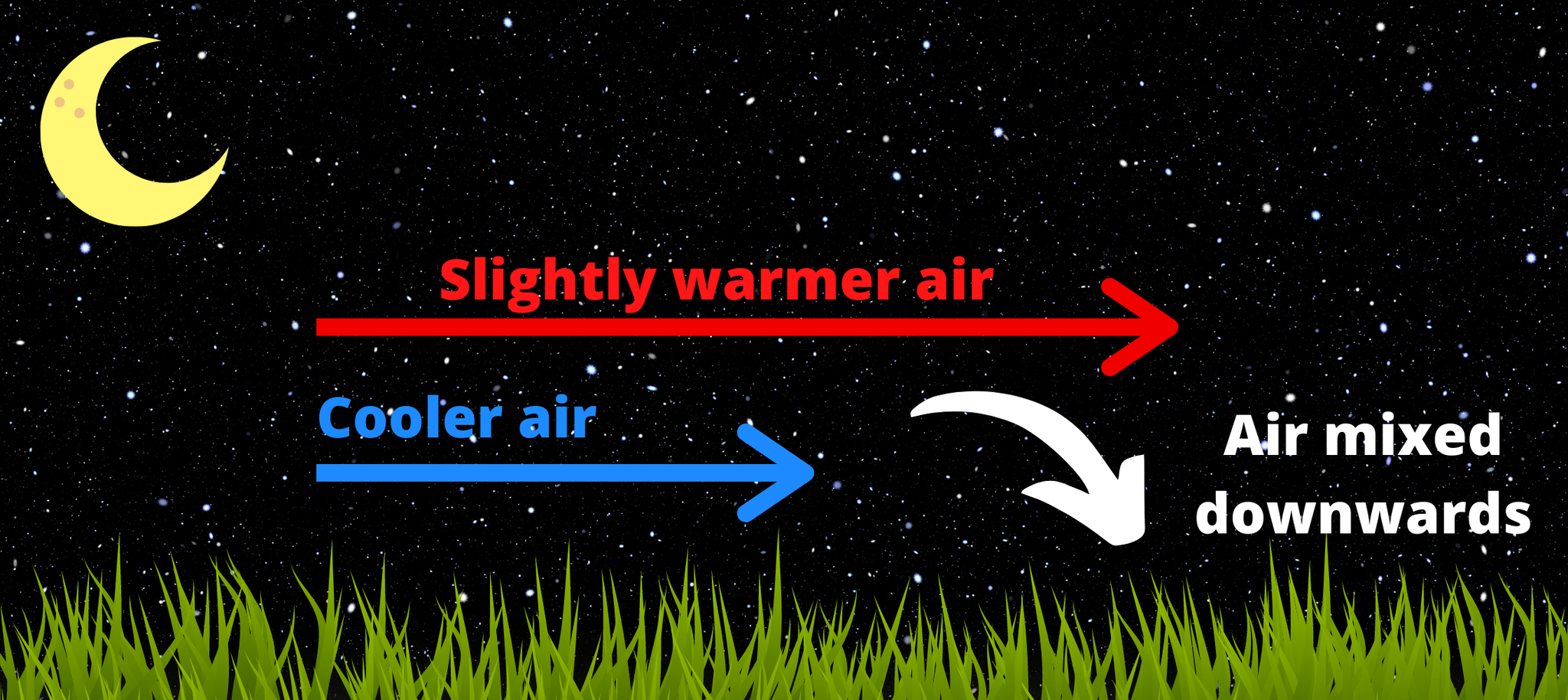
What about at night? The coldest temperature of the night occurs just before dawn. The surface cools by radiating heat back into the air. With the most cooling occurring at the surface on a windy night, slightly warmer air above the surface is mixed downwards. This happens because the winds above the surface are stronger (as you can see in the image below). The mixing prevents the temperature from dropping.
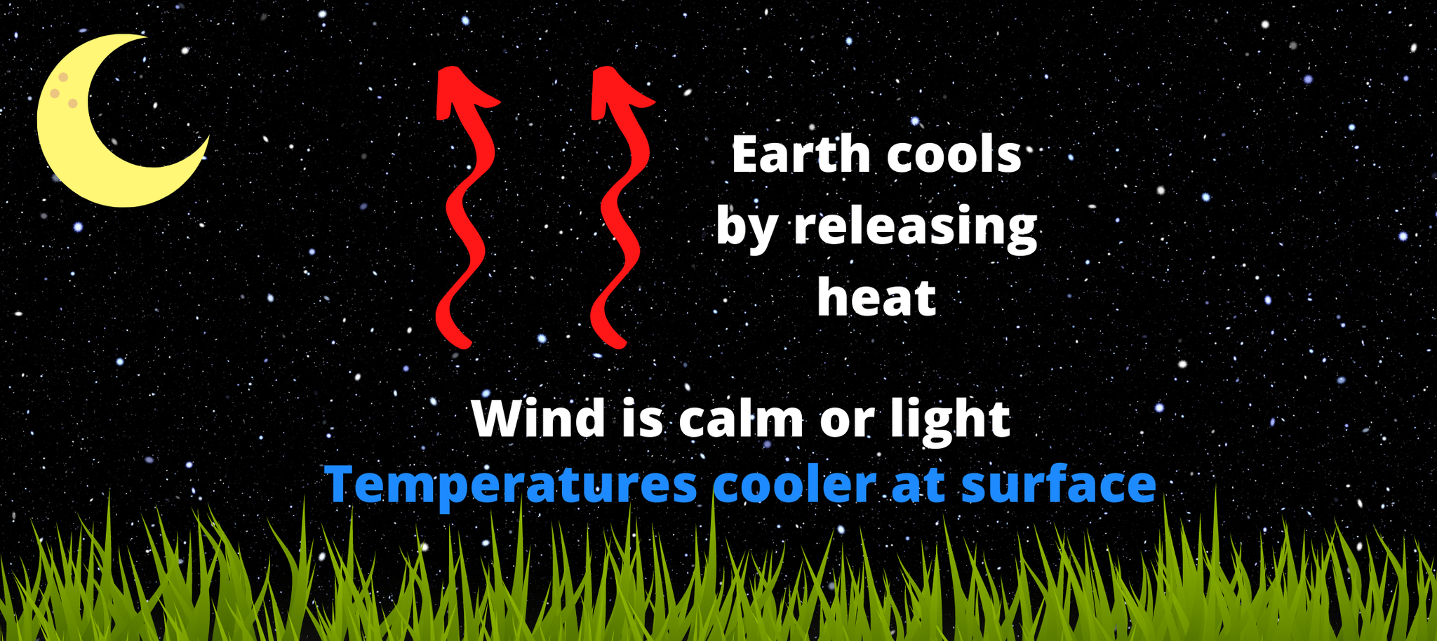
If the nighttime wind is calm, there is little warm air aloft being mixing downward, so the temperatures will drop more. Rule of thumb - Expect slightly warmer night temperatures on a windy night and slightly colder night temperatures when the wind is light.
Final thoughts
When forecasting winds, you have to look both at their strength and from where they are coming. What if you have a stronger southerly wind during the daytime? This scenario may bring in a warmer air mass with it and warm the daytime temperature. Winds bringing in moist air limit how much the air warms, in which case the daytime temperature may be lower, and there is not as much cooling at night. This concept of winds bringing in warm, cold, moist, or dry air from one point to another is known as advection.
It's complicated, right? Well, you also have to remember there are winds throughout all levels of the atmosphere, which all play a role in influencing our temperature, and air masses moving in. Meteorology is never simple ;)

0 Comments Add a Comment?