The flying eagle supercell... It's not a patriotic storm
There is always a tremendous feeling of pride when I see the bald eagle flying overhead. My heart soars with each spread of the bird's majestic wings. Eagles are a sign of independence and freedom of the United States. Just head to Grafton, IL for their eagle-watching tours and you'll likely have similar feelings.
There is nothing patriotic when referring to the flying eagle in a meteorological context. The flying eagle is a radar signature that correlates to a supercell's strength.
Compared to other types of storms, supercells are the least common. However, they can cause damaging winds, large hail, and strong tornadoes. They are unique due to the rotating updraft within the thunderstorm, known as the mesocyclone.
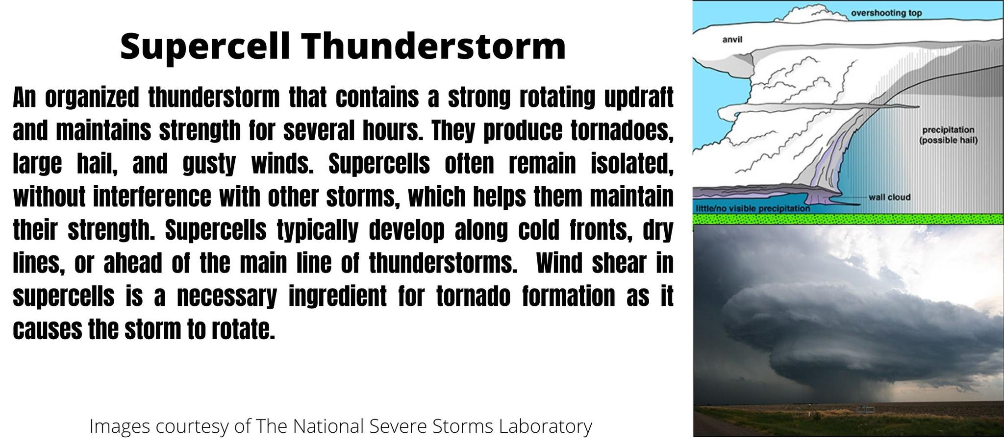
Similar to regular thunderstorms, they require ingredients such as lift, moisture, and instability to develop. Wind shear is the fourth ingredient essential for the development of the rotating updraft and causes the storm to tilt.
The tilt of the supercell prolongs its life by separating the updraft and the downdraft. When these features stack vertically, the storm weakens and eventually dies out.
Supercells can be classified based on their structure and how much precipitation they produce. For example, there are the classic supercell, high precipitation supercells, and low precipitation supercells. I won't go into these today, but I will focus on a radar signature that is a testimony to the storm's strength. As you might have guessed, this signature is the flying eagle.
Another word for this radar signature is v-notch, but in this blog, I will refer to it as the flying eagle.
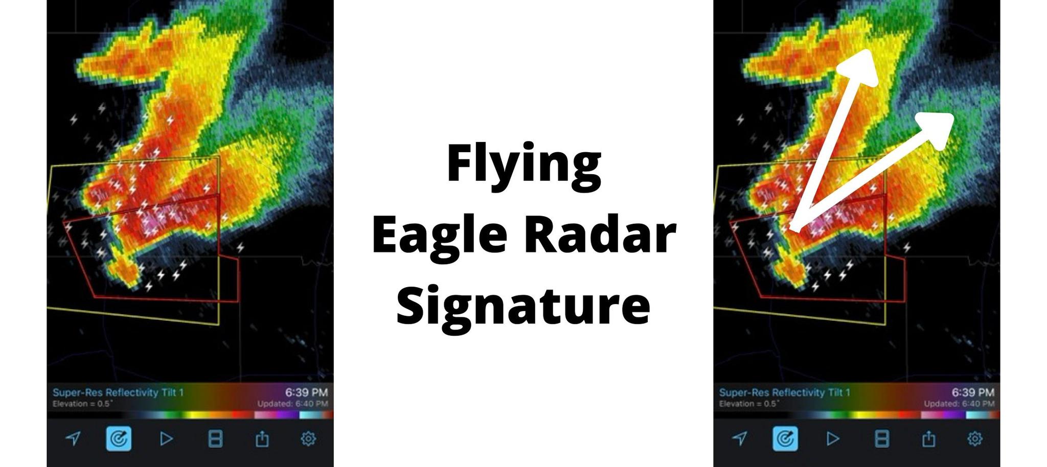
The radar images below are a textbook example of this radar signature. Basically, because of the spread of the storm, it looks like eagle wings taking the shape of a large V. This signature is usually only seen with the strongest supercells but is not necessarily a precursor to tornadoes. With that being said, the strongest supercells are more likely to be tornadic, so seeing this radar signature is a bad sign.
In the case of this radar image, which is from May 4th, 2022, a tornado did develop and caused extensive damage in Lockett, TX.
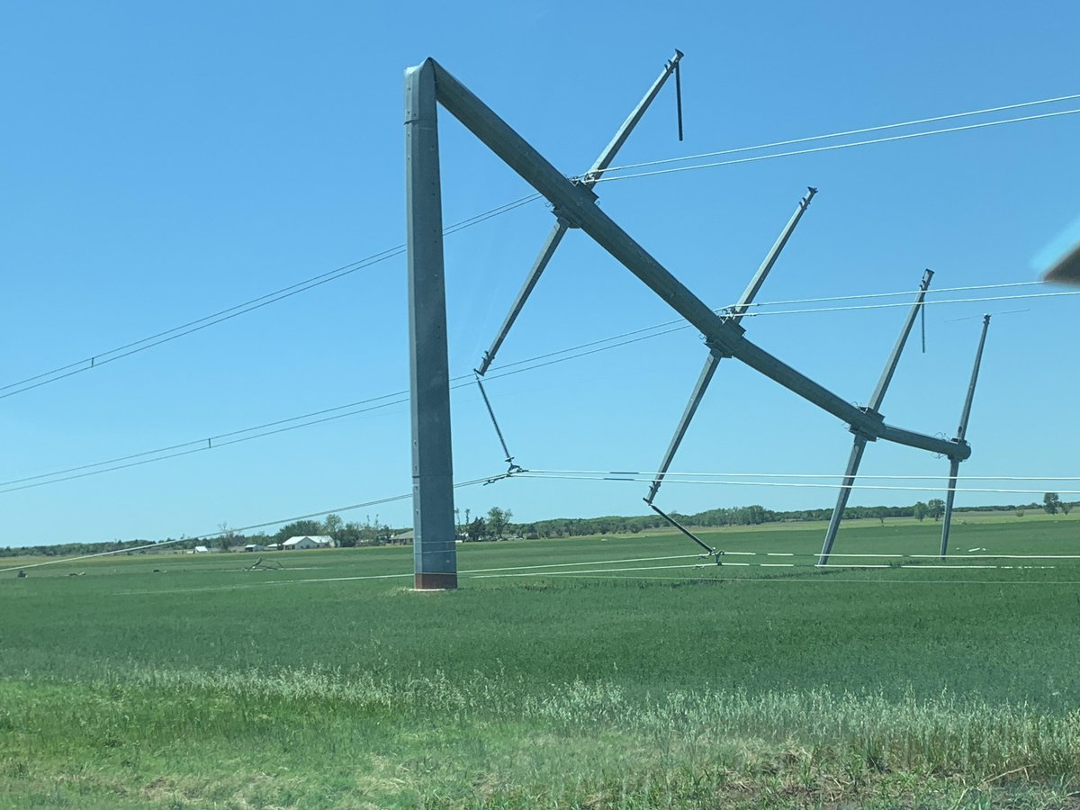
Damage surveys continue, with EF3 damage found near Lockett, Texas from last night's storm. Metal power poles bent almost down to the ground. EF3 damage near Lockett, with 140 mph winds likely. #texomawx #tornado pic.twitter.com/ljild50Eui
— NWS Norman (@NWSNorman) may"="">https://twitter.com/NWSNorman/... 5, 2022
The flying eagle develops when the storm's updraft becomes so strong, that winds are forced around the updraft, spreading precipitation outward in the V shape.
If you see this signature, you know that the mesocyclone within the storm is strengthening. If supercells are rotating, then tornadoes are possible. At the earliest sign of rotation, supercells are tornado warned, and in the warning text, "radar indicated rotation" will be noted as the reason for the warning.
Never wait for a confirmed tornado to take a warning seriously. Any type of weather warning is a potentially life-threatening or dangerous event. Take shelter immediately.
If you're interested in learning more about supercells,
USA Tornadoes is a great resource.

0 Comments Add a Comment?