Q&A - Ask Away! I'll Answer pt. 7
I'm working on finishing up answering the questions you all sent to me last week. Be sure to check back over the next few days as I'll reaching out asking for you to send in more questions.
As a reminder, you can submit questions in the comment section of this post or email me directly through the website contact form. You can also send questions through any of my social media platforms. Find me @leahwx11 on Facebook, Twitter, and Instagram. If I miss your question, keep commenting on futures posts! I want ALL your questions answered.
Question - When the snow melts how much water will it make?
Let me say, THANK GOODNESS the snow to water equivalent is not one to one, or else we would have major flooding after every snowfall.
Snow is composed of tiny ice crystals, but there is also a lot of air surrounding those ice crystals. The volume of snow mainly air. Think of cotton candy, it’s mostly air with little strung sugar crystals. The water content of the snow, the structure of the snow crystal, the temperature outside, and wind speeds all factor into how much water is in each flake. Typically, 10 inches of snow is the equivalent of one inch of water. In this case, the snow to-water ratio would be 10:1. This is not always the case. For example, the snow-to-water ratio may be 6:1, where more water is present in the snow. So, for every 6 inches of snowfall, there would be one inch of water.
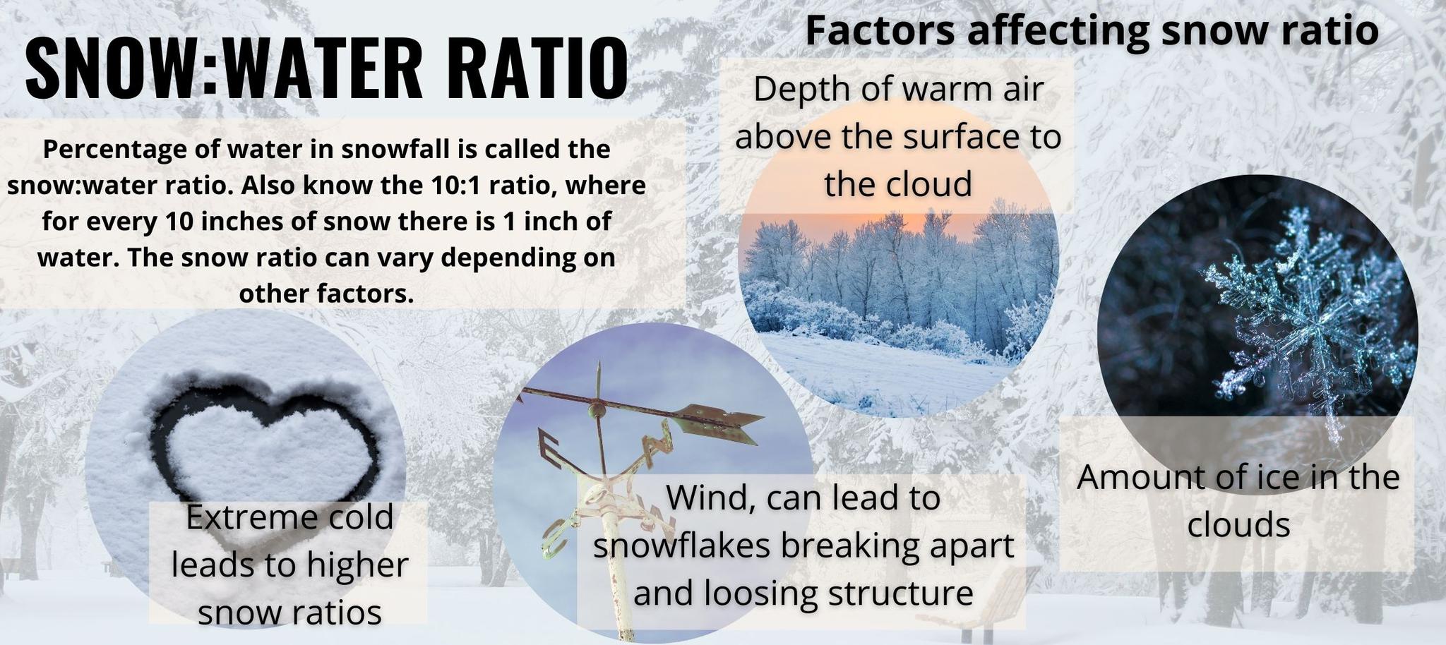
Drier and colder air often leads to powdery snow. Just think of the snow we had a couple of weeks ago. It was fluffy because of the lack of water in each snowflake. In these cases where we have powdery snow, the snow-to-water ratio may be 12:1, where 12 inches of snow equates to one inch of liquid water.
This link has some good stats from the United States Geological Survey. For example, assuming the water-to-snow ratio was 10:1, then if 1 inch of snow fell evenly on one acre of land, it would melt into about 2,715 gallons of water.
Question- Will we have a wet or dry summer? And are you expecting very many storms through our area?
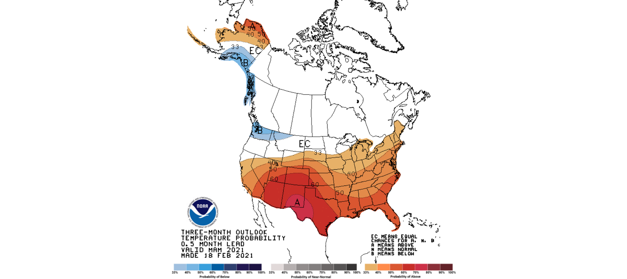
I’ve touched on spring outlooks in the previous post you can read by clicking HERE. The image below is the updated temperature outlook for spring (March through May). The darker the color, the higher the confidence that there will be above/below-average temperatures. Looking at the map below, we have about a 40% chance of seeing above-average temperatures. So, you can expect spring to be a little warm this year.
The precipitation outlook has Missouri in the “equal chance” region, meaning there is not enough information to determine if there will be above or below-average precipitation. Out West, notice the brownish contours indicating overall drier conditions. Those areas will still see rain, but overall the pattern is trending towards below-average rainfall.
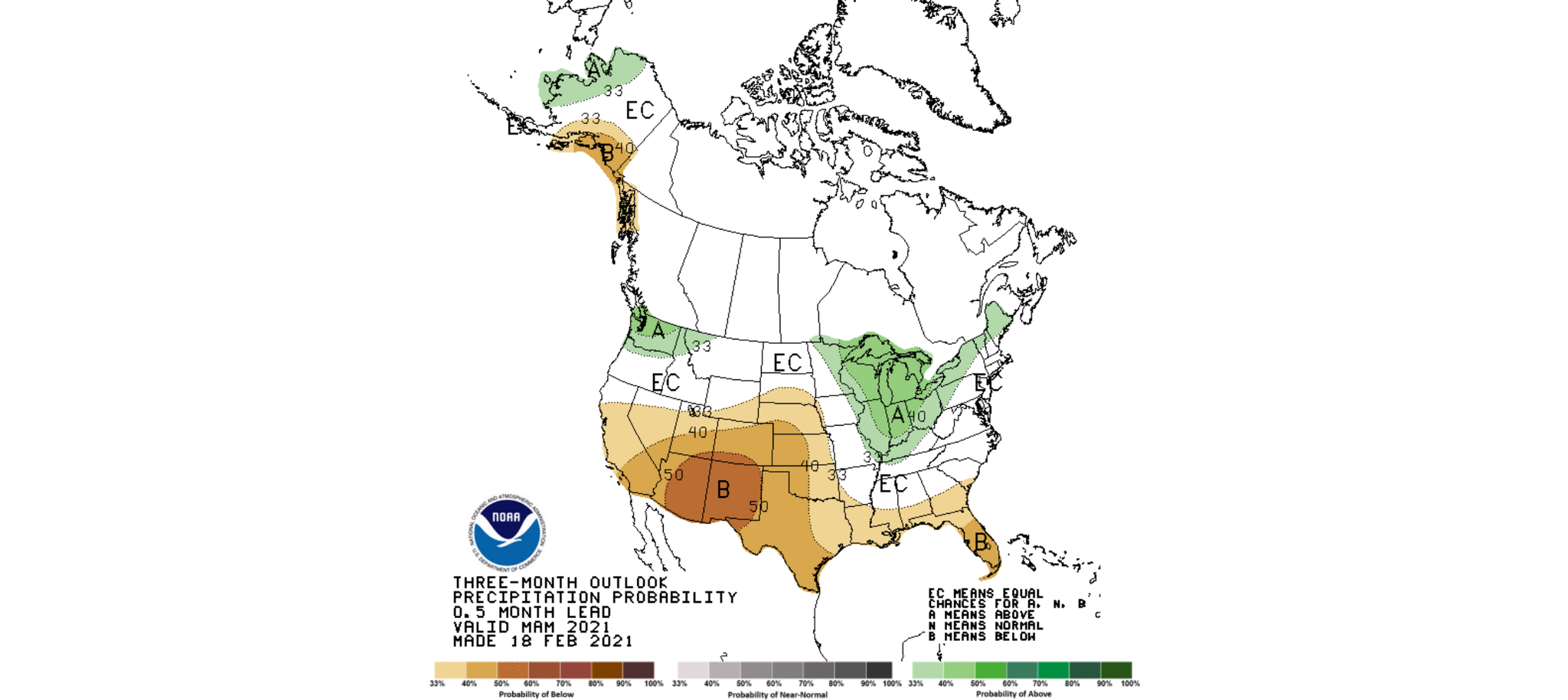
We are in a La Nina pattern; that tends to bring an increased risk for stronger storms. So there will still be rain, but we likely won’t see it until later in the spring season (April and May). The way models are trending right now, March seems to be right on par with average rainfall. The average rainfall for Springfield in March is 2.52”, we will be close to that.

0 Comments Add a Comment?