Breaking down the threats - What you should know about severe weather Part. 2
Last week was the first of a three-part series on severe weather. You can refresh yourself on storm structure, formation, and how tornadoes form by clicking HERE.
This week, I’m breaking down how tornadoes are classified. I will also explain the differences between the tornado and severe weather watches and warnings.
History of the Enhanced Fujita Scale
Unless a wind instrument is placed directly in a tornado's path, which is extremely difficult to do, there is no straightforward way to measure its wind speed. Thankfully, we have a solution, known as the Fujita Tornado Intensity Scale, or F Scale, named after the brilliant scientist Dr. Tetsuya Theodore Fujita of the University of Chicago.
The F scale classifies tornadoes based on the severity of the damage. The scale ranges from F0, the weakest tornado, to F5, the strongest tornado. After a tornado hits, engineers and meteorologists conduct a damage survey. They pour over past radar data, take witness testimonies, and assess any photos or videos available. They then estimate the winds of the tornado and assign a rating accordingly.
When the F scale was introduced in 1971, it was revolutionary. However, there were flaws. For example, the scale did not accurately account for the building's structural engineering and how winds would damage them. Future research determined the wind estimates on the F scale were too high for categories F3 and greater. Even Dr. Fujita later admitted the scale had shortcomings and needed adjustments.
The Enhanced Fujita Tornado Intensity Scale (EF Scale) replaced the F scale in 2007. The new scale accounts for 28 damage indicators such as building type, structures, trees, towers, and poles. The enhanced scale helped solve the wind overestimation problem. This is the scale we currently use today.
Tornado classification - wind speed and damage
The following image details the differences between the scales. Take note of the winds and the overestimation on the F Scale. Secondly, you will notice the detailed damage description on the EF scale.
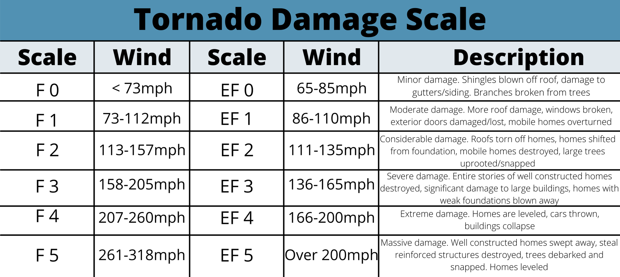
An important note is the shape and size of the tornado are not an indication of strength.
Violent tornadoes are EF4 or EF5. These tornadoes account for about 70% of tornado-related fatalities. However, they are rare, only accounting for about 2% of all tornadoes.
Breaking down the watches/warnings
All watches/warnings are a call to action. A watch means pay attention, keep up with the forecast, and start implementing your safety plan. When a warning is issued, you need to take action, go to your safe spot, and stay indoors.
Local TV meteorologists do not issue watches or warnings. The job belongs to the Storm Prediction Center (SPC) and the National Weather Service (NWS). However, there is some degree of collaboration.
Severe Thunderstorm Watch
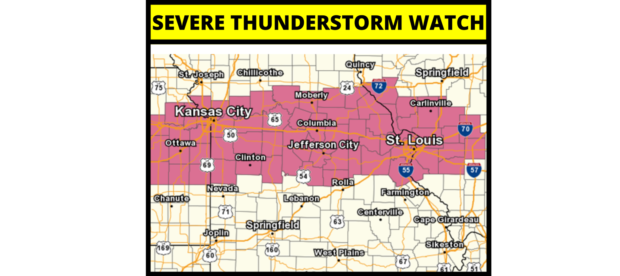
May be issued several hours in advance of storms moving in. The watch is not a guarantee storms will occur, but they are possible. Severe thunderstorm watches are issued when winds within future storms are expected to be 58mph or greater, AND/OR potential for hail of one inch in diameter or larger.
The SPC in Norman, OK, issues the watches. Local NWS offices may make adjustments by either adding or eliminating counties as needed during the watch duration. On radar maps, the watch will show up as a pinkish/reddish color.
Severe Thunderstorm Warning
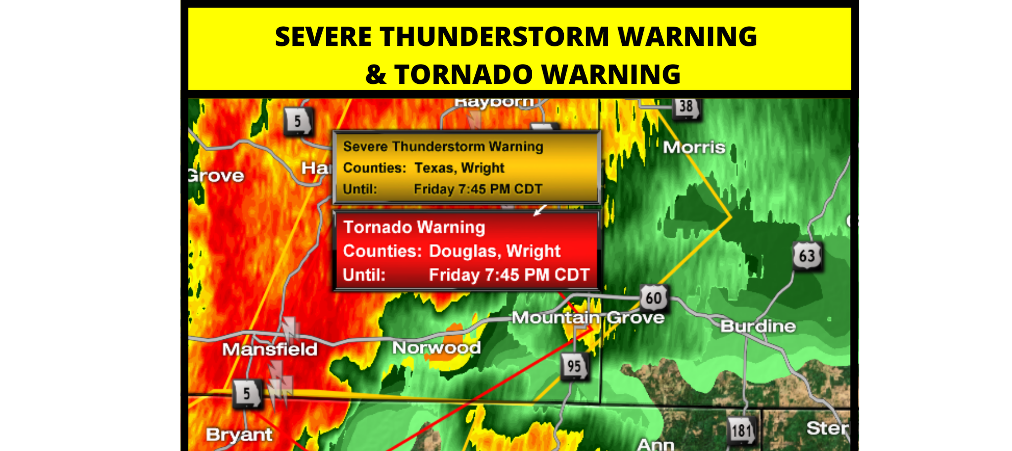
These are issued as the storm is occurring. There does not need to be a pre-existing severe thunderstorm watch before a warning is issued. To meet warning criteria, winds in the storm may gust 58mph or greater, with one-inch hail. A storm may receive the warning tag if the threats have been radar identified or through a storm spotter report. These warnings have a duration of about one hour, will include where the storm was located, what towns are in the path, the threats, how fast the storm is traveling, and the direction of the storm. When a warning is issued, take action. Stay inside and go into your safe shelter. Severe storms are strong and can produce tornadoes with little or no warning. Severe thunderstorm warnings are issued by the local NWS forecast office. On a weather map, a severe thunderstorm warning will have a yellow polygon.
Tornado Watch
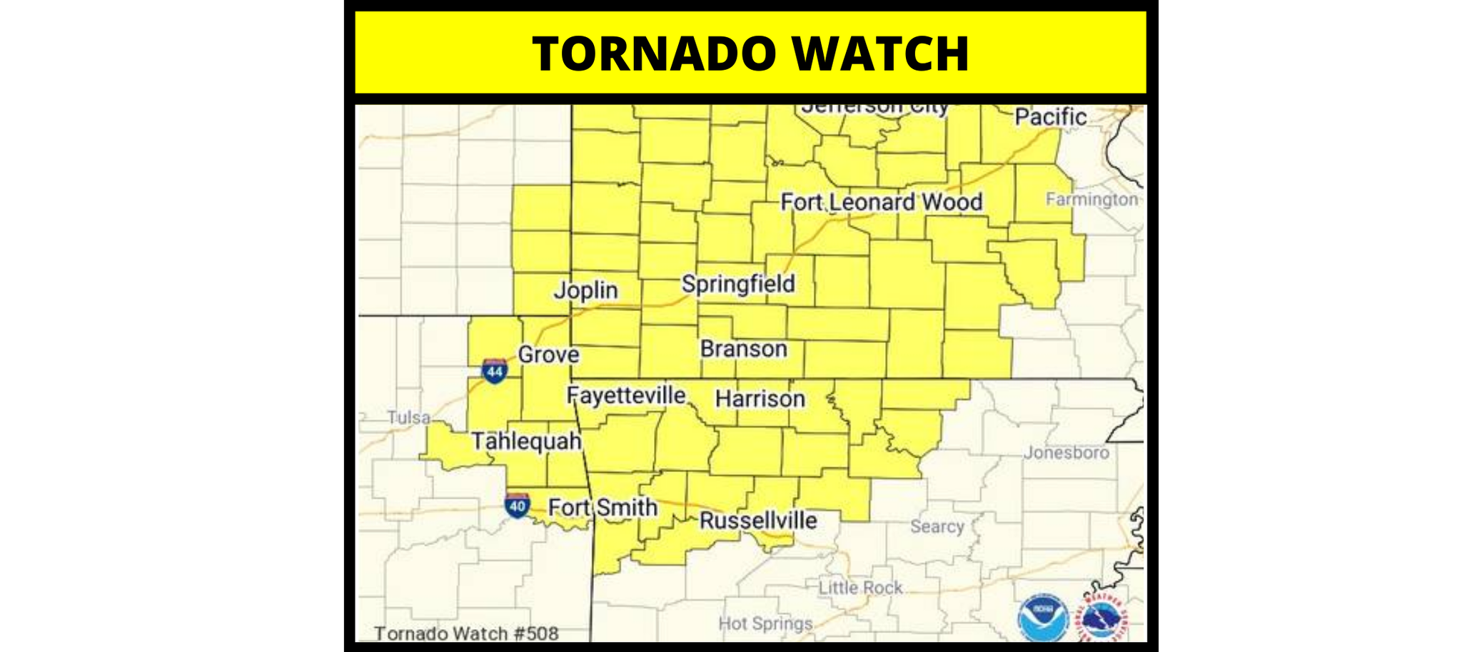
The Storm Prediction issues tornado watches about four to eight hours in advance of storms moving in. If you're under a tornado watch, review your tornado safety plan and prepare to move into your safe shelter should a tornado develop. These watches are issued when conditions are favorable for tornadoes within the watch area. On a weather map, the counties included in the watch area will be yellow.
Tornado Warning
Similar to severe thunderstorm warnings, tornado warnings are issued either when a tornado is radar indicated, or when a storm spotter makes a report. On radar, we can determine if a storm has rotation, indicating a mesocyclone or lower-level rotation. Radar also estimates wind speeds, and may even pick up debris swirling in the air because of a tornado. If these tornado signatures are present, a warning will be placed on the storm. If a storm spotter sees a tornado or even a funnel, a warning may also be issued. The warning will include information such as the storm's location, the path, speed, and what towns are in the path. When a warning is issued, go to your tornado shelter. This may be a basement, an interior room such as a closet, or even your bathtub.
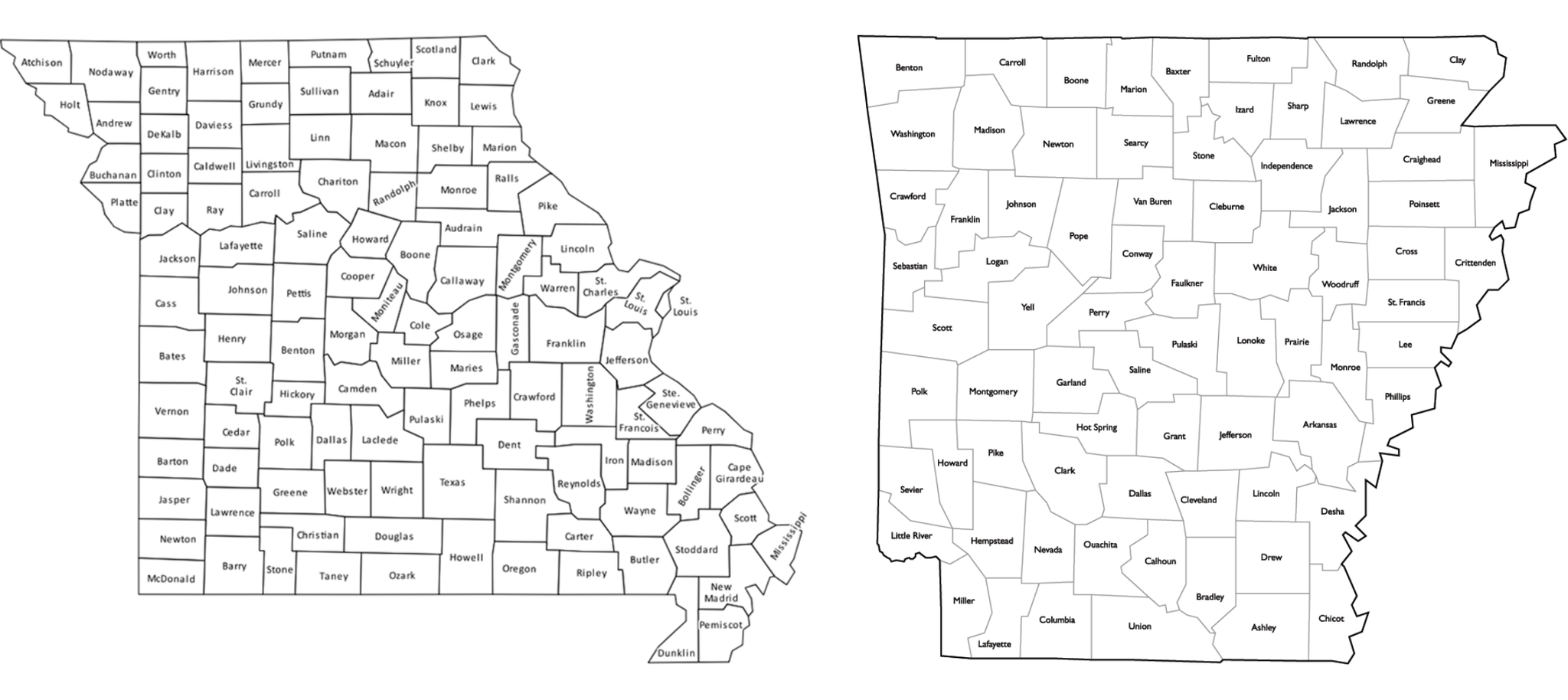
Meteorologists often refer to specific counties when talking about watches, warnings, and threats for severe weather. Become familiar with your county and those surrounding it. Also, learn where the major cities are within your county. The county maps for Missouri and Arkansas are posted below.
Coming next week! March 16th:
While tornadoes and severe storms steal the attention, they are not the only threat we face here in the Ozarks. Flooding and strong winds are what affect us most. Check back next week as I will break down the risks associated with flooding and strong winds.

0 Comments Add a Comment?