It's all about the Highs and Lows
Maybe this will come as a shock to you, but the weather has been pretty boring recently! Sure, we've had hot spells and a few cold fronts, but otherwise, the pattern has been stagnant.
With no threat for severe weather to divide my attention, this is a great time to talk about weather blocking patterns! Recognizing these patterns as they develop will clue you in on future weather conditions.
A weather block leads to a stagnation of weather lasting several days or even weeks. The repeated weather pattern causes droughts, flooding, above-normal temperatures, or even below-normal temperatures.
Look for these blocking patterns in the higher levels of the atmosphere. In previous discussions, I've talked about the role high pressure and low-pressure play in driving the weather. High pressure is associated with calmer weather, while low pressure usually brings storms. Pressure and temperature are directly related, so that if the pressure increases, you may also see an increase in temperatures and vice versa.
With that short review in mind, let's look at the patterns.
Blocking High
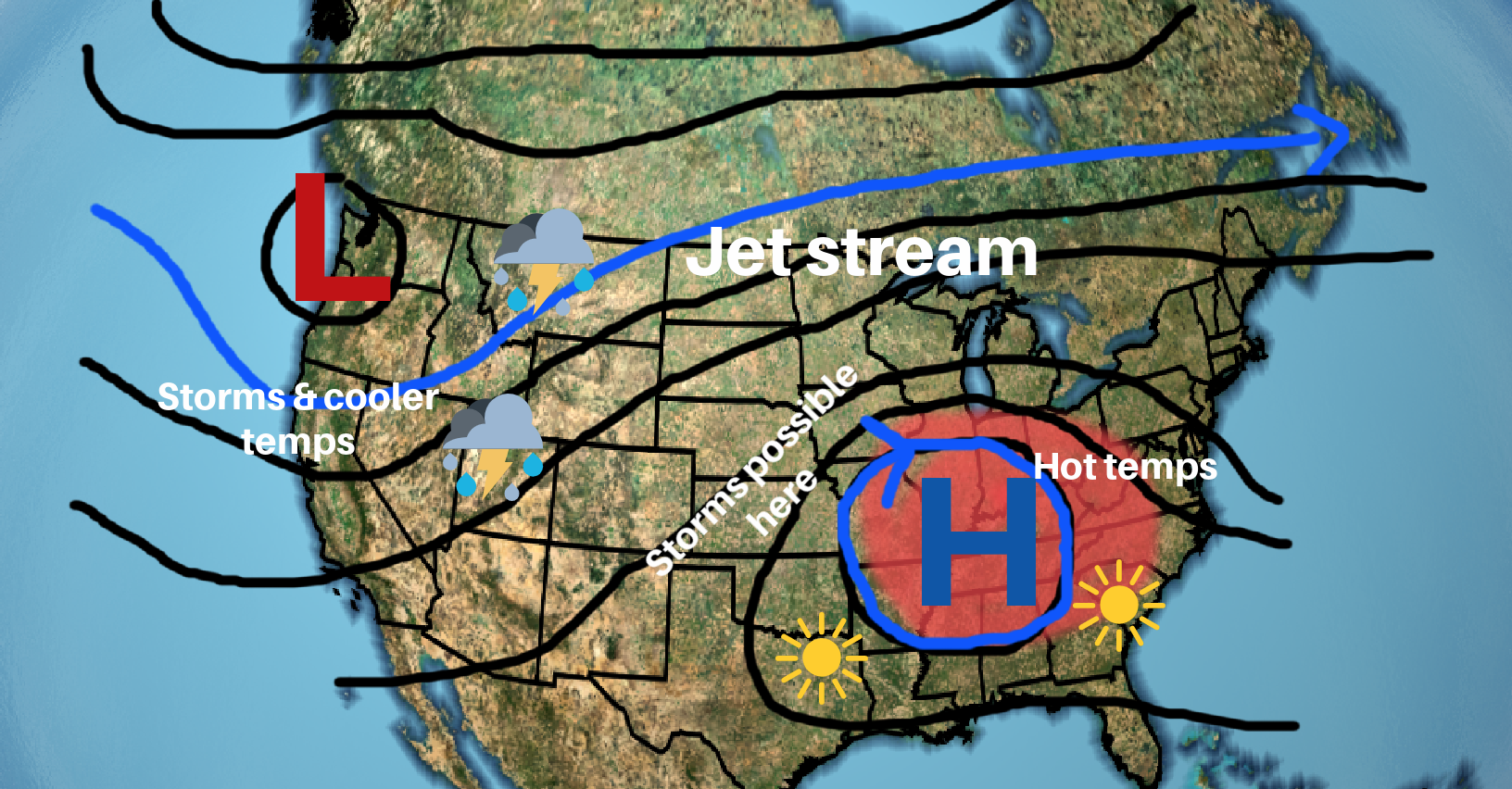
We've been under the blocking high for just about the entirety of summer. These ridges of high pressure are often responsible for heatwaves and limited rainfall. If any rain can develop, it occurs on the edges of the high pressure. High pressure in the upper levels of the atmosphere causes the air to sink, warming the air as it falls. When the sun heats the surface, the falling air under the high pressure traps the warm air below. These two factors are responsible for summertime heat waves.
Eventually, the blocking high will erode when low pressure moves in or when a strong jet streak develops. Even hurricanes moving inland can cause the pattern to break down.
Cut-off high
Similar to the blocking high, a cut-off high may also develop. These high-pressure systems are common in the summer over the Southeast US. The cut-off high brings hot weather to the southeast states, while the clockwise flow around the high allows warm and moist air to move into the Ozarks. Areas on the edges of the high pressure may see some thunderstorm development, particularly in the afternoon.
Omega Block
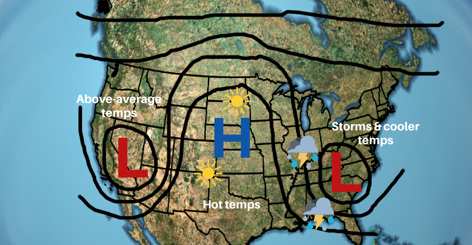
This blocking pattern resembles the Greek letter omega when analyzed on the upper-level weather model charts, where the two areas of low-pressure sandwich a high-pressure ridge. Under the high-pressure, you'll experience dry weather for a prolonged time. The low-pressure can lead to persistent rainy patterns and clouds. The right low pressure is also known for bringing cooler than average temperatures, while the left side low pressure brings warmer than average temperatures. Flooding and drought conditions can occur with this blocking pattern.
Cut-off low
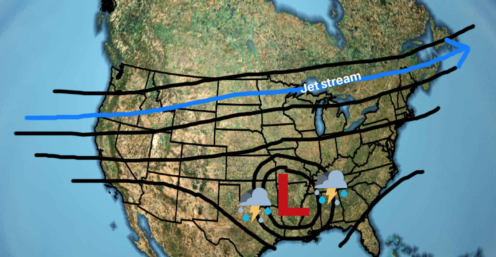
The winds in our upper atmosphere are what drive our weather. As the winds shift they may cause upper-level high pressure or low pressure to become cut-off from the main flow. In the case of a cut-off low, the jet stream will lift north and cause the circulating low pressure to park over a region. Cut-off lows can bring days of rainfall for areas underneath.
Rex Block
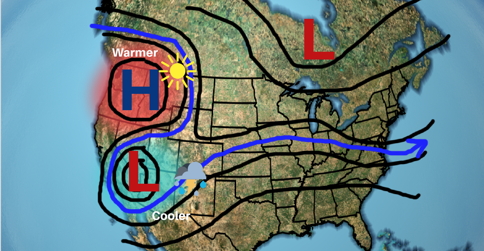
Think of this pattern as a backward S. Wind circulates clockwise around high pressure over the northwest US and then turns counterclockwise around the low pressure to the south. The high and the low will remain stationary until one gains intensity and breaks the pattern. Under high pressure, you will find mild conditions and warm weather. The southern low pressure brings stormy conditions.

0 Comments Add a Comment?