Saturating the atmosphere
When I was a Junior in college, home for winter break, I remember driving down my street as the snow fell. I watched the flakes waft through the air, and I pondered the cloud dynamics that went into creating those tiny crystals. Or, once, when it was raining, I watched the raindrops collect on the car window. I would guess which droplet would win the race down the side of the glass, and considered the cooling effects of evaporation as the water fell through the air.
It is not uncommon for me to become lost in thought over a random meteorological topic.
The water cycle - Simplified
You’ve likely heard of the water cycle. Water evaporates out of oceans, from the ground, and off of plants. Evaporation replenishes the water vapor content in the atmosphere. Eventually, we get clouds and precipitation.
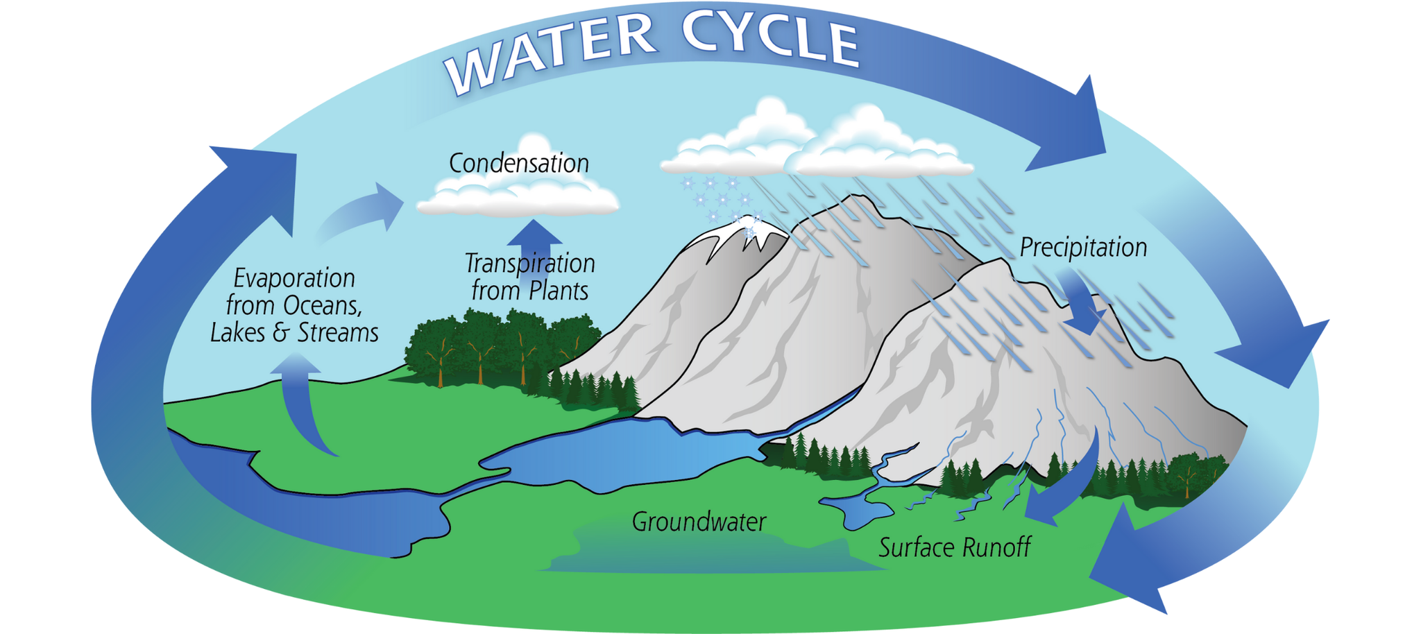
Precipitation, in any form, is essential for returning water to the earth. This is the water cycle, in simple terms.
Water and temperature relationships
Warm air can hold more moisture than cold air. Because of this, you need more water vapor to form raindrops compared to snow or frozen precipitation.
When air reaches saturation, it no longer has the capacity to hold any more moisture, and precipitation is the result. Saturation can occur in two ways.
First, we need lots of moisture to evaporate into the air. How much moisture air can hold is a variable of temperature. Consider this, for roughly every 2°F rise in temperature, the air can hold about 7% more moisture. When moisture capacity is reached, the air is saturated.
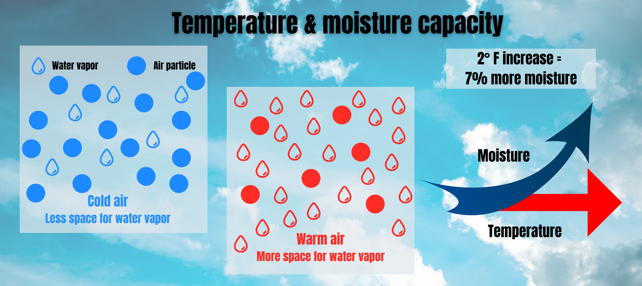
Another way to reach saturation is by cooling the air. This will effectively lower the amount of moisture the air can hold, and allow air to obtain saturation faster. Clouds are typically produced by this method.
Quick talk on precipitation types
The two processes work in unison. Even if the cloud is composed of ice crystals, saturation can still be reached. Either way, when the water droplets or ice crystals are too heavy, they fall to earth as rain or snow (or some form of mix).
The water droplets and the snow crystals have quite the journey on the way down, going through many layers of the atmosphere. Their final form upon landing may not necessarily be how they started, this depends on the temperature.
If temperatures are at 32° or lower under the base of the clouds, then the precipitation will generally fall as snow. If any of the layers between the clouds and the surface are relatively warmer, we get mixed precipitation. Forecasts are much more complicated in these situations... Finally, if the temperatures are above freezing, we see rain.
Rain doesn’t only fall when temperatures are warm. What we consider "Warm" or "cold" is very relative. 33° is relatively warmer than 32°, however, that one-degree temperature difference impacts whether the precipitation will fall as snow or rain.
Now, there are some exceptions to what I mentioned above. In Colorado, snow has fallen in the mountains when temperatures are in the 50s. This is very rare, and the temperatures aren't in the 50s for long as the falling precipitation cools the air. But, it can happen.
This is when you have to look at the temperature profile under the clouds, the cooling effects of the precipitation, whether or not there is cold air advection, etc. to determine the precipitation type.
The good news is, you never have to worry about this. A meteorologist's job is to analyze temperatures in the atmosphere and forecast precipitation. What a fun job.

0 Comments Add a Comment?